
 European Union


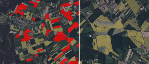
The new article has been posted on the LAB/opegieka blog. This time we have decided to share our knowledge about the possibilities of using the multi-temporal radar satellite imagery collected via the Sentinel-1 mission in order to detect the winter rapeseed crops. The created prototype of classifying solution had been tested during works within two voivodeships. The effects of that had been described in the latest article.
In the article you will find more information about:
- the execution of the multi-temporal analyses in order to detect winter rapeseed crops;
- the way of overcoming the constraints resulting from using the Sentinel-2 data;
- the effects of implementing the architecture of convolutional neural networks.
CLICK HERE for the full article.


