
 European Union


It is a pleasure to start our new series of articles called Geodata in business. The articles, being a part of the series, are aimed at pointing out and discussing the benefits of exploiting the geodata in a chosen industries. We have decided to begin with the polish photovoltaics market, which is the fastest growing industry regarding the renewable energy.
Polish photovoltaics
Polish photovoltaics market is characterised by having a great capacity. According to the Polish Institute for Renewable Energy it is the fastest growing branch of the polish renewable energy market. The institute estimates, that Poland would maintain the pace of growth regarding the power generated by photovoltaic arrays. That is supposed to lead to maintaining the fifth position in the EU regarding the annual growth of the power sourced by photovoltaic arrays. It is also predicted, that the market turnover would increase by up to 25% in comparison with previous year, at the same time exceeding 5 bln PLN.
The experts claim, that vast majority of the investments will concern micro and small photovoltaic arrays crafted to suit the needs of the individual and business prosumers. They were the ones who played the crucial role in the market’s growth last year. More than 70% of the power was generated by micro PV arrays. In 2020 their impact certainly will not decrease. Already, in the first quarter of the year, almost 300 MW had been connected to the network. That equals almost the half of the power generated within the whole 2019.
Challenges of the PV market
The undergoing market growth, especially noticeable within the sector of photovoltaic farms and individual prosumers, creates the opportunities for engineering, procurement and construction entrepreneurships, as well as polish producers and suppliers of photovoltaics solutions. Currently, they face the series of challenges. They are strictly related to the size of the investment, the prosumers’ characteristics, but also the uncertainty caused by the global pandemics’ consequences. The commonly implemented methods based on field inspections are not always possible to execute. What is more, they are time-consuming and require a serious staff engagement, what make them ineffective.
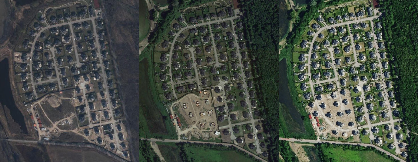
Aerial photography acquired in Walendów (from the left):
Geoportal 2017, Google 2018, HxGN Content Program 2019
Geodata in investments capacity analysis
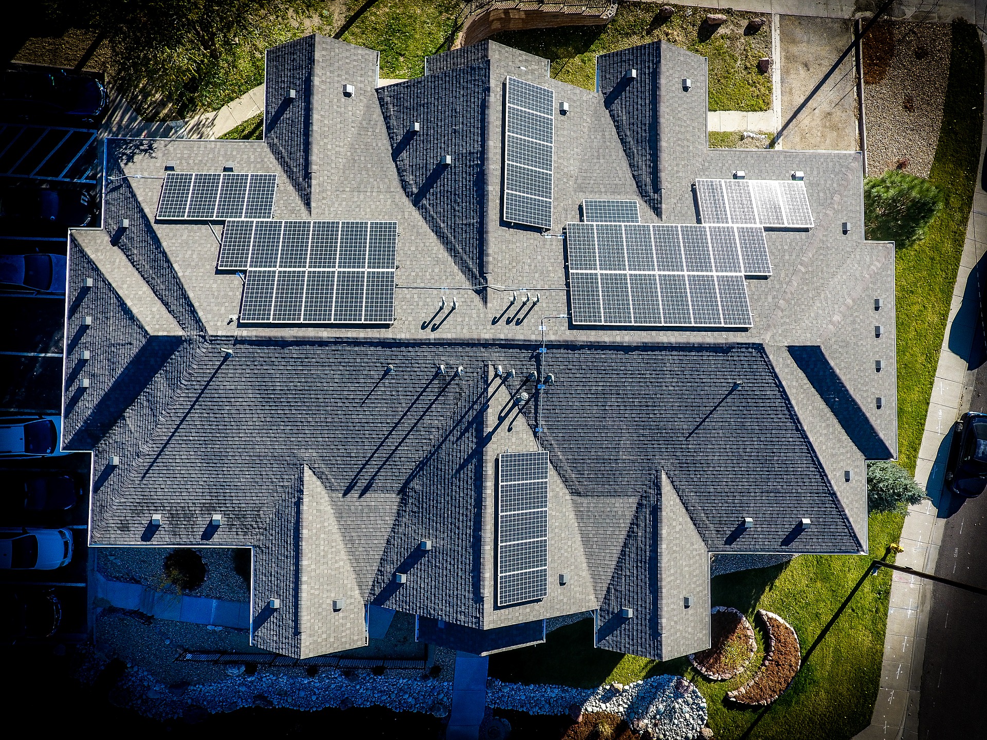
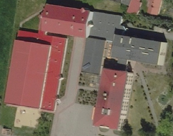
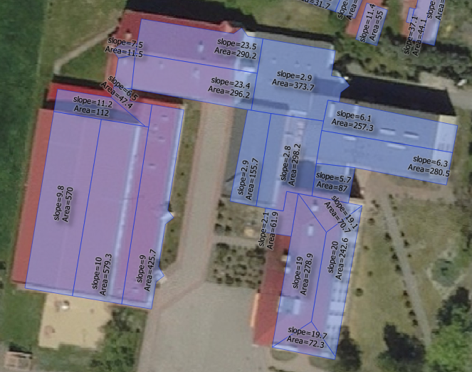
This is the space for the geodata to shine. The aerial imagery could be immensely useful during the process of photovoltaic investments’ assessment. The current, homogeneous and cloudless aerial imagery, make it feasible to automatically analyse the rooftops’ area and pitch, define the size and location of the shadowing infrastructure, as well as assess the resources used to tile the roof in order to choose a supporting infrastructure for the solar modules.
The benefits of geodata-driven analysis
- Complete analysis at an arm’s length
The aerial imagery allows for easily measuring the required attributes in order to assess the capacity of the photovoltaic investment. The algorithms are capable of quickly calculating the area and pitch of the roof, as well as locate potentially adjacent shadowing infrastructure within the area of the investment. Moreover, exploiting extra registers enables to locate the hook-ups and power grids. The geodata provides a full view on the capacity of the investment.
- Time and cost efficiency
Well exploited geodata enables to achieve the major reduction of time spent on analysing the capacity of the investment. Most of work is conducted by algorithms, thus cutting short the number of staff allocated to that task to the absolute minimum. Furthermore, the aerial imagery covers vast areas. Due to that, apart from quick data acquisition for the needs of whole neighbourhoods and farms, it is possible to cut the costs concerning business trips as the whole process is undertaken remotely.
- Current data without leaving the office
It is possible for the companies from the PV market to gather the required data without leaving the office. It is one of the advantages of exploiting geodata in the process of photovoltaic investments’ assessment. Such solution have a beneficial impact not only on the abovementioned cost and time frame of the task execution, but also comfort and, what is even more important these days, the employees’ safety.
Changes on the PV market?
It seems that the polish photovoltaics market could provide even more efficient growth to itself, due to including the geodata into the process of investment assessment. Both prosumers and farm owners, as well as firms installing the photovoltaic arrays could grasp the opportunity of exploiting the aerial imagery. Will we notice the growth of the geodata involvement within the photovoltaics market in the foreseeable future? The extent of exploiting the aerial imagery depends on the willingness of the investors to try the latest technologies in their projects. Currently the most common methods involve field inspections and those in a bigger picture are inferior to the geodata in terms of efficiency.
Properly suited data will allow for implementing the new solutions as soon as possible. If you would like to increase the efficiency of your PV analysis’ using the geodata, please get in touch with us. The person responsible for a direct contact is:
- Karolina Wróbel
Business development specialist
karolina.wrobel@opegieka.pl
Notes:
- Rynek Fotowoltaiki w Polsce 2020; report of the Polish Institute for Renewable Energy.
- Analysis based on the CAPAP (LOD2) data.
- Dom bez rachunków; Polish Organization of Development the Heat Pumps Technology.
- Own materials.


